Connecticut’s first state park is still one of its finest. Located on the shore of Long Island Sound in Westport Connecticut, Sherwood Island State Park covers 234 acres of beach, wetlands and woodlands. Visitors come to the park to walk, bike, swim, fish, study nature, watch birds, fly kites, fly model airplanes, play volleyball, picnic, or just relax under the trees.
Introduction & Maps
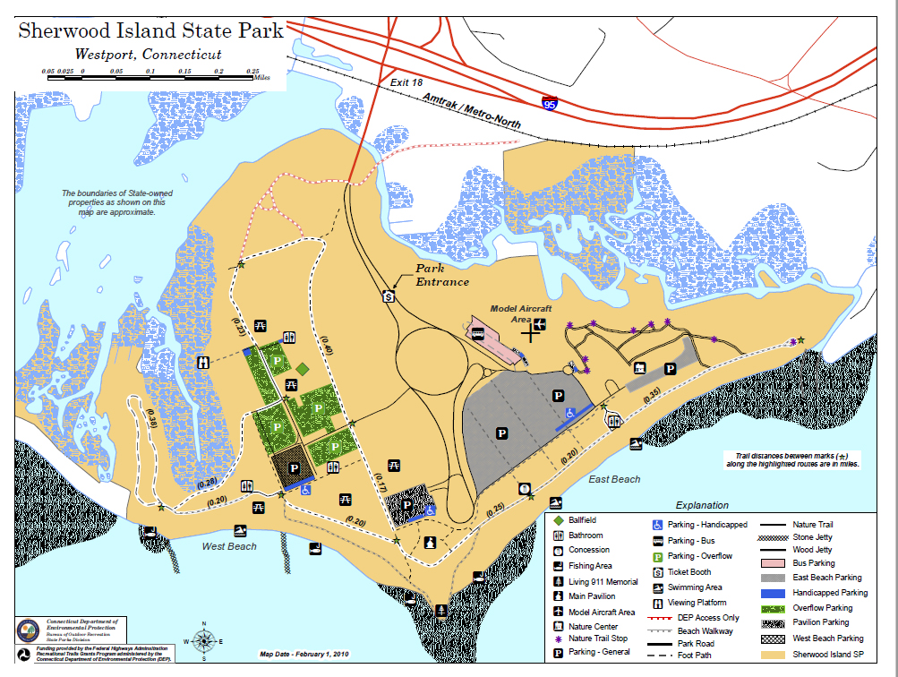
Major Sections of the Park Include:
- Sherwood Point – Including the Pavilion (food concession, tables, public restrooms) and Connecticut’s 9/11 Memorial.
- East Side – Including the East Beach, the Nature Center, the salt marsh, grassy walking paths, and the model airplane field. The East Beach has a public bathhouse, restrooms, a pavilion, picnic tables, and grills.
- West Side – Including the West Beach, forested walking trails, and the disc golf course. The West Beach has a public bathhouse and restrooms. Picnic tables and grills are located in much of the West Side.
You can learn more about the park by exploring this section of our website.
Fees
There is no parking fee for visitors with Connecticut registered vehicles. From April 1 to October 31, the parking fee for visitors with out of state registered vehicles is $22 on weekends and holidays, $15 on weekdays. The fee is $7 after 4:00 PM.

Directions
From I-95 north and south: Take Exit 18 to access the Sherwood Island Connector. Follow the Connector directly into the park.
From Route 1 north and south: take the Sherwood Island Connector in Westport. Proceed past the I-95 entrance/exit ramps directly into the park.
From Route 15 northbound: Take Exit 41 and proceed south on Route 33 to Route 1. Follow Route 1 north to the Sherwood Island Connector in Westport.
From Route 15 southbound: Take Exit 42 and follow Route 57 south. Go left onto Route 33. Proceed south on Route 33 to Route 1. Follow Route 1 north to the Sherwood Island Connector in Westport.